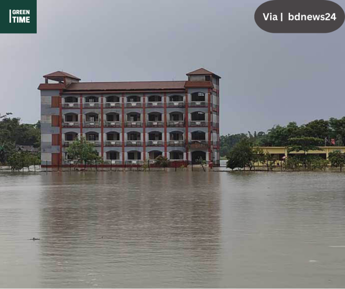
According to the assistant meteorologist at the Meteorological Office, there is a possibility of light to moderate rain with temporary gusty winds in Sylhet for the next three days.
Due to continuous rains and hill slopes coming down from upstream for the past few days, the water of important rivers in Sylhet is flowing over the border.
At the same time Goainghat and Jaintapur upazilas of the district were flooded along with the lower areas.
Goainghat Upazila is the executive officer. Tauhidul Islam said that the roads, haor and lower areas of 13 unions of Goainghat upazila were flooded due to sudden floods caused by torrential rains and water coming down from upstream. Due to adverse weather and flooding, the Goainghat Upazila administration has set up 56 shelters. People have come to these shelters.
Various points on the road from Upazila Sadar to Jaflong and some roads to Sylhet have seen an increase in water; however, this has not disrupted road communication.
Additionally, he stated that each ward should have a sufficient number of boats available for emergency rescue and disaster management operations.
The upazila administration reports that flood water has inundated two points on the Sarighat-Goainghat road, and Shimultala on the Goainghat-Radhanagar and Jaflong routes. Floods have occurred in Rustumpur, Lengura, Daubari, Nandirgaon, East and West Alirgaon, West Jaflong, and Middle and East Jaflong of the upazila.
As per Wednesday noon data, water at Goainghat Bridge Point is flowing over 10.11 cm (latitude: 10.82) and Sarighat Point at 12.88 (latitude: 12.35) cm.
In order to prevent accidents caused by hills and landslides, Upazila Executive Officer Touhidul Islam has asked the residents living in the upazila’s hilly foothills to stay in the safe shelter the administration has designated.
Meanwhile, flooding has affected the lower areas of Jaintapur Upazila in Sylhet. The water of the Sari, Bara Nayagong and Rangpani rivers of the upazila is flowing above the limit.


Upazila Nirbahi Officer Umme Salik Rumaiya said, “We are monitoring the flood situation caused by the torrential rain in the hills and the people of the lower areas have been asked to take safe shelter and evacuate their cattle. The upazila has constructed 48 shelters. Residents of some areas have gone to shelters. Several areas including Nijpat, Jaintapur and Charikata Union of the upazila have water in the lower areas.”
Deepak Ranjan Das, executive engineer of the Sylhet Water Development Board, said the same.
According to information from the Water Development Board, Sylhet, during the pre-monsoon season, the water level in the Kanighat area of the Surma River is 10.80 cm.
There was 12.45 centimeters at 9 am on Wednesday.
At the Amalshid point of the Kushiara River, the water level is 13.5 cm.
The water level of this river was 15.22 centimeters at 9 am on Wednesday.
The Kushiara river algae area is 10.70 cm wide.
On Wednesday, at 9 a.m., it was 11.66 centimeters.
The latitude at Sarighat Payant on the Sari Goain River is 10.70 cm.
On Wednesday, at 9 a.m., this point had 11.29 centimeters.
The latitude at the Goainghat point of the Sari-Gwain River is 8.65 cm. On Wednesday, at 9 a.m., this point had 9.73 centimeters.
Shah Mohammad Sajib Hossain, assistant meteorologist at the Sylhet Meteorological Office, said, “For the next three days, there is a possibility of rain with temporary gusty winds and light to moderate stormy winds in Sylhet.” Sylhet has recorded 146.1 mm of rain in the last 24 hours from 6 a.m. to 6 p.m..”

