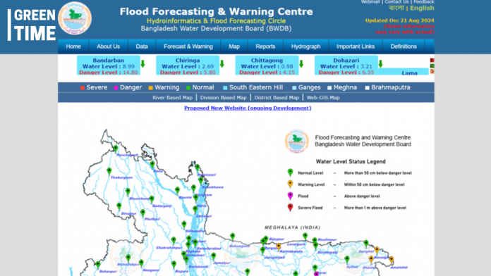
As of Wednesday, August 21, torrential flash floods have inundated several parts of Bangladesh. With water levels rising rapidly, it’s crucial for residents and authorities to stay informed and cautious. Here are two reliable ways to track the ongoing floods:
- Flood Forecasting & Warning Centre (FFWC):
Operated by the Bangladesh Water Development Board (BWDB), this website provides comprehensive, real-time data on water levels across the country. The FFWC offers river-based, division-based, and district-based maps, as well as Web-GIS maps. These maps categorize water levels into four distinct statuses:
Normal Level: Water is more than 50 cm below the danger level.
Warning Level: Water is within 50 cm below the danger level.
Flood: Water is above the danger level.
Severe Flood: Water is more than 1 meter above the danger level.
Access the FFWC here: http://www.ffwc.gov.bd/
- Google Flood Hub:
Google’s Flood Hub is an AI-driven, real-time global flood forecasting tool. This initiative utilizes publicly available weather data from multiple sources, including ECMWF forecasts, CPC rain gauge measurements, IMERG precipitation data, and satellite imagery from the European Space Agency’s Copernicus Sentinel-1. In Bangladesh, Flood Hub relies on local historical and real-time data provided by the BWDB, ensuring highly accurate forecasts tailored to the region.
The use of these advanced tools is critical for understanding and anticipating flood risks. Residents in affected areas are encouraged to regularly check these platforms for updates and take necessary precautions to stay safe during this challenging time.

