



By Mamun Kabir
When we visit the haor, the first scene that catches our eyes can become the whole story of the haor if we look at it only through the eyes of a tourist.
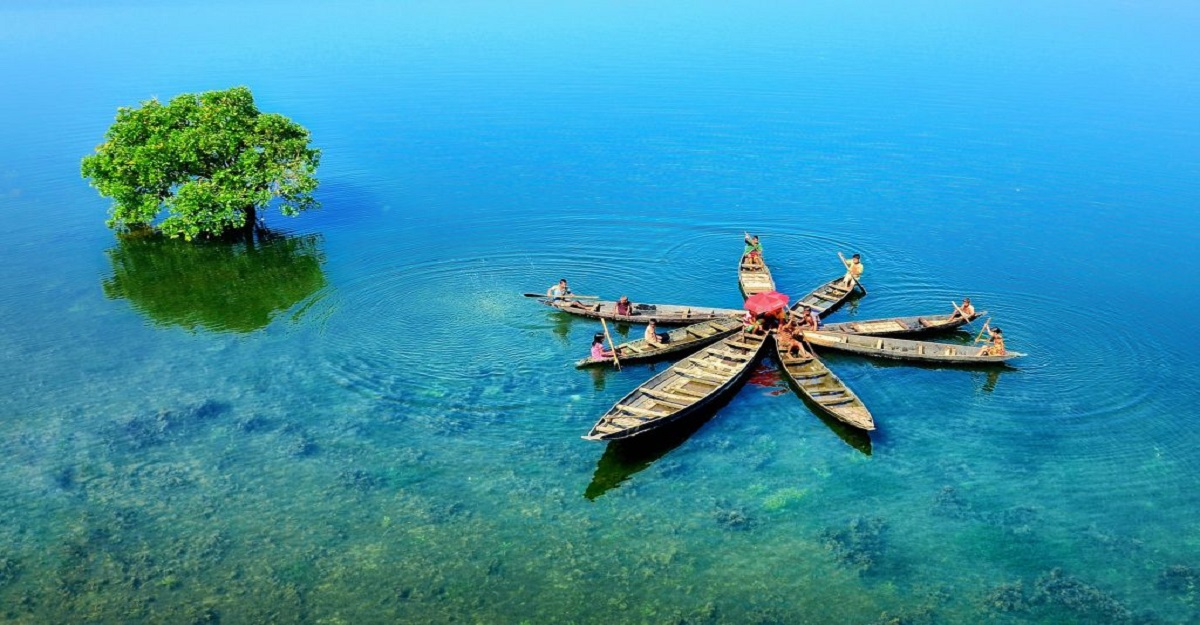
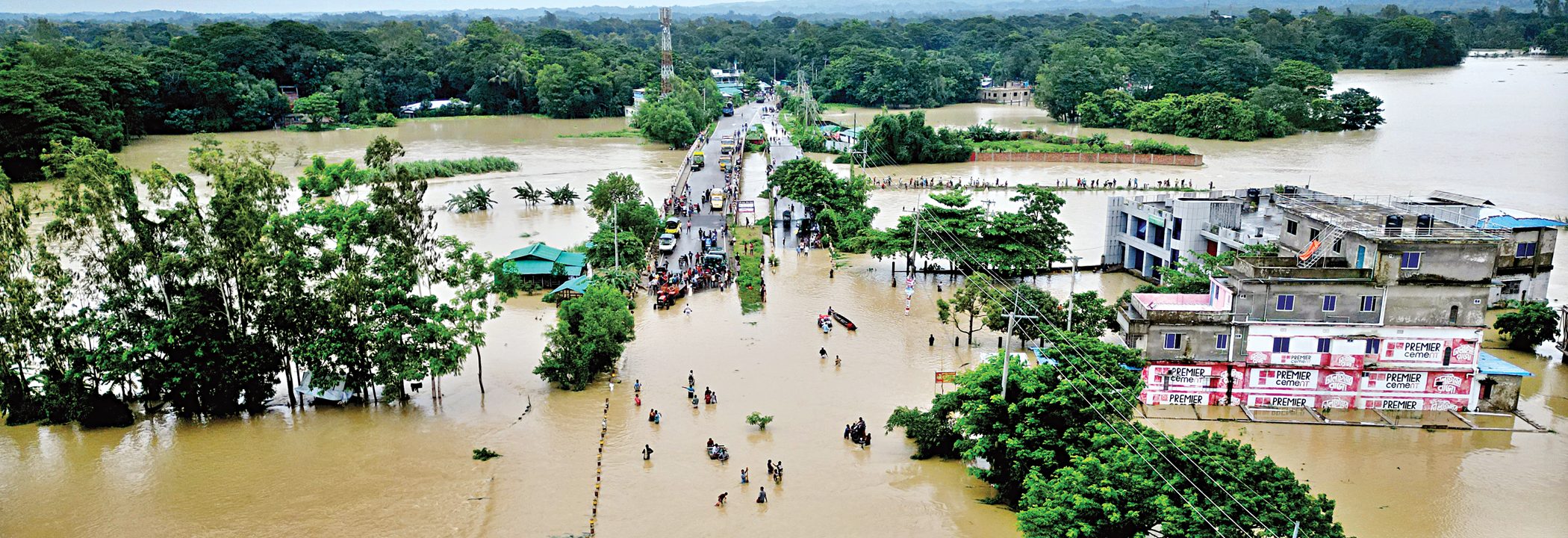
During the monsoon, water stretches in every direction. We travel by boat. In the distance are villages, boats moving across the water, a vast sky overhead, and an endless expanse of water below. In some places, only the tops of trees remain visible; elsewhere, a house appears like a tiny piece of land floating in the middle of the water. We take photographs, record videos, and marvel at the scenery.
But within this very landscape lies another Bangladesh where water is not only a source of beauty, but also a source of livelihood risks, barriers to communication, and, at times, a lack of access to safe drinking water.
We usually look at the haor from above. To understand its real reality, we have to come down to the lives of its people.
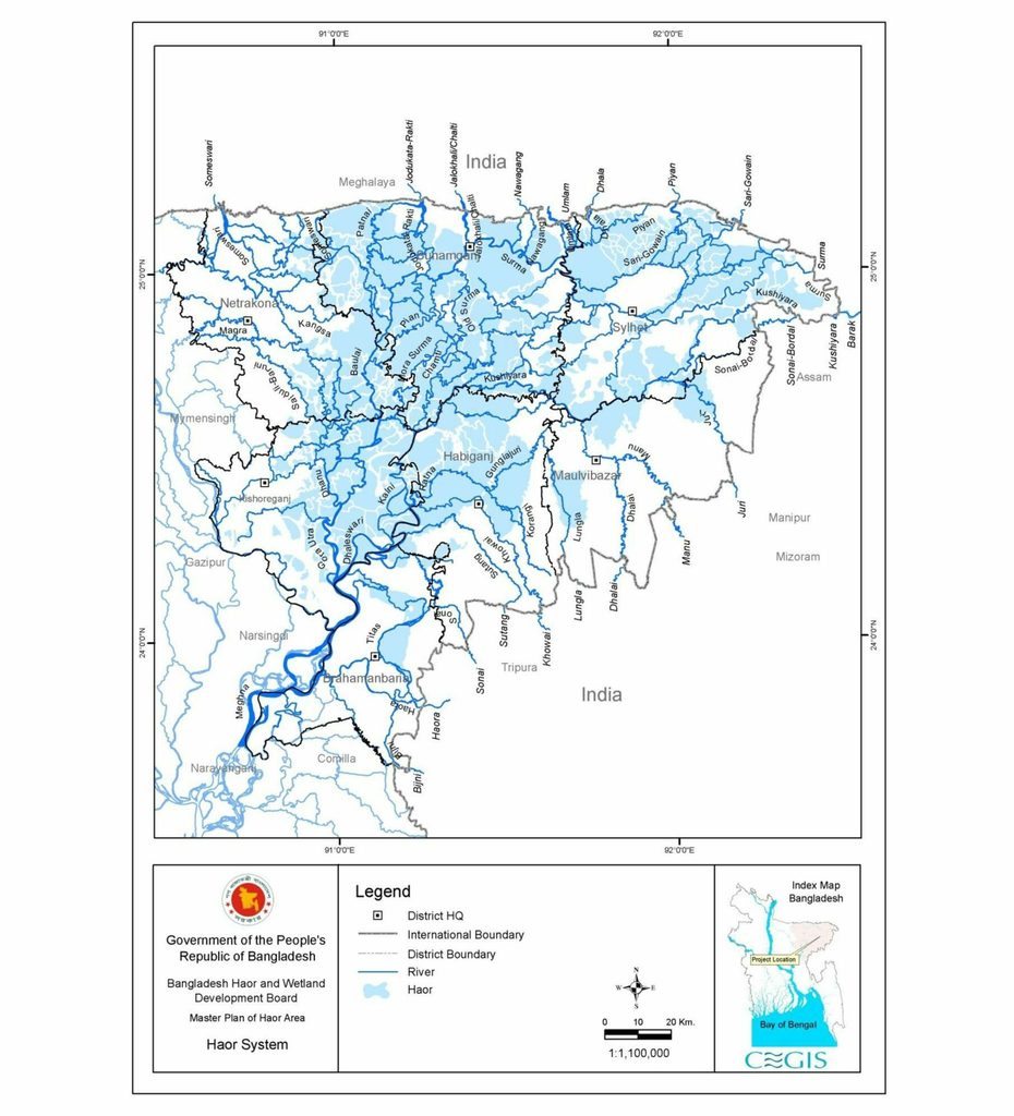
The haor region, spread across seven districts in northeastern Bangladesh, covers approximately 19,998 square kilometers. According to government data, around 19.37 million people live in the region, which contains 373 haors and wetlands. The region is also important for the country’s food production, fisheries and the ecological balance of its wetlands.
In other words, the haor is not a marginal geography. It is an important part of Bangladesh’s economy and environment.
Haor of north-east region of Bangladesh (BHWDB, 2012)
List of all haors in Bangladesh: Click here to see the list
The Paradox of Water: Too Much, Yet Not Enough
Perhaps the greatest paradox of the haor lies here: there is water everywhere, yet access to safe drinking water is not guaranteed.
During the monsoon, when water sources become contaminated, collecting safe drinking water becomes difficult. Sanitation systems are also placed at risk. The consequences affect entire households, but women and children often bear a disproportionate share of the burden.
For people in cities, water is often viewed primarily as a matter of supply. For people in the haor, water is simultaneously a question of supply, health, transportation and disaster.
This difference is important for policymaking as well. Installing a tube well in a haor village and declaring the water problem solved is not enough. We also need to ask: does the facility remain usable during the monsoon? What happens if the water becomes contaminated? What is the alternative source? How will sanitation facilities remain functional?
These questions must be part of the planning process.
A Family’s Future Resting on a Single Crop
Boro rice is at the heart of the haor economy. Land that remains submerged during the monsoon turns into rice fields during the dry season. For many farmers, this is the main and sometimes almost the only crop of the year.
As a result, boro rice is not simply an agricultural commodity; it is the foundation of a family’s annual financial planning. Alongside the costs of seeds, fertilizer, irrigation and labor come calculations for debt repayment, food, healthcare and children’s education.
The problem is that this entire economy depends on an extremely narrow window of time.
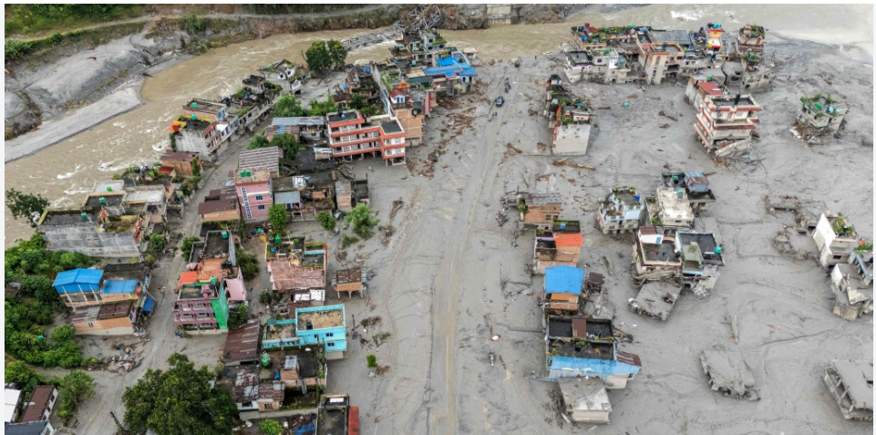
Once the rice begins to ripen, it must be harvested quickly. If a flash flood or sudden surge of water from the hills arrives before that, months of labor can disappear beneath the water.
A similar picture of devastation emerged across seven haor districts from late April to early May 2026. According to the Ministry of Agriculture, 49,073 hectares of cropland were affected, around 236,000 farmers were impacted, and approximately 213,000 tons of boro rice were lost. The estimated financial loss was around Tk 10.47 billion.
These figures raise a larger question is ‘We keep asking farmers to produce more, but how much have we done to reduce the risks they face in producing it?’
For haor agriculture, therefore, increasing yields alone is not enough. Timely early warnings, rapid mobilization of farm workers and harvesting machinery, boats, safe storage, and financial protection after crop losses must all be treated as parts of the same system.
Because when a crop is lost, a farmer does not simply lose rice; he also loses his capacity to invest in the next season.
The Problem Is Not Just the Crop, It Is the Risk
The vulnerability of haor farmers lies partly in their dependence on a single crop. But an even greater vulnerability is the lack of alternative sources of income when that crop is lost.
That is why livelihood diversification needs to be placed at the center of haor development policy. Ducks, livestock, fisheries, climate-resilient agriculture, small businesses, or seasonal employment whatever works in a particular area should be developed in ways that are connected to actual markets.
Training alone will not be enough. Without access to credit, technology, markets and buyers, livelihood diversification projects can ultimately become just another short-term project that ends when the project period does.
There Are Fish, But Where Is the Fisher’s Security?
Fish are another pillar of the haor economy. According to data from the Department of Fisheries, the haor region contributes around 14 percent of the country’s total fish production. But pressure on this resource is growing due to the degradation of natural breeding grounds, disruption of fish migration routes, overfishing, pollution and changes in wetlands. The impact is felt most directly in the livelihoods of poor fishing communities.
This presents an important dilemma for development policy. We want to increase fish production, while also protecting the natural habitats that sustain fish populations. We cannot solve the problem by treating these two goals separately.
The canals, beels and fish migration routes of the haor must be protected. At the same time, fishers need to be made active partners in managing these resources. They know which wetlands are important breeding grounds at different times of the year and where fish migration routes lie. Such local knowledge is not a substitute for an official map; rather, it is an essential complement to it.
Boats in the Monsoon, Rice Fields in the Dry Season
Another defining reality of the haor is that the same landscape supports two very different ways of life over the course of a year.
During the monsoon, places where movement is difficult without a boat become rice fields in the dry season. Ignoring this seasonal transformation when planning permanent infrastructure can make projects inefficient, impractical or unnecessarily expensive.
That is why the question of connectivity in the haor should not be measured simply by asking, “How many kilometers of roads have been built?”
The more important questions are- How long does it take a patient to reach a health facility during the monsoon? For how many days can a student attend school? When the harvest begins, how quickly can farmers bring in workers or machinery?
In other words, haor infrastructure needs to be assessed in terms of its usability across seasons. The solutions must reflect the geography of each location.
Poverty Here Is About More Than Low Income
According to government data, around 29.56 percent of people in the haor region live below the poverty line. But even this figure does not capture the full picture of vulnerability in the haor.
A family having a low income is only one dimension of poverty. When that is combined with seasonal isolation, uncertainty over access to safe water, limited healthcare, dependence on a single crop and the burden of debt following disasters, the same level of income can translate into a far more precarious life than it would in other regions.
In other words, if we measure haor poverty only in terms of income, we leave out an important part of the problem.
Climate Change and the Growing Challenges of Bangladesh’s Haor Region
Bangladesh’s haor region is one of the country’s most distinctive landscapes and one of the places where climate change is increasingly exposing the vulnerability of rural livelihoods. Spread across the northeastern part of the country, the haors function as vast seasonal wetlands: submerged during the monsoon and transformed into agricultural land during the dry season. For millions of people, this seasonal cycle is the foundation of their livelihoods.
The greatest vulnerability lies in agriculture. Boro rice is the dominant crop, and for many farming households it is the main source of annual income. The problem is that the entire production cycle depends on a very narrow window before the arrival of pre-monsoon floods. According to the World Bank, the average number of days available for cultivation in the haor region has fallen to around 15-20 days, compared with about 30 days a decade earlier. This shrinking window makes farmers increasingly vulnerable to changes in rainfall and the timing of flash floods.
The scale of the risk can be seen from previous disasters. Between 1993 and 2010, major floods caused substantial crop losses in four different years, damaging about 70 percent of cultivated areas during those events and resulting in the loss of approximately 2.44 million tonnes of rice. In 2017, a devastating flash flood destroyed around 90 percent of boro production in the affected haor region.
The problem is not simply that Bangladesh receives too much water. It is that the timing, intensity and unpredictability of water are changing. The World Bank notes that both pre-monsoon and monsoon rainfall are projected to increase, potentially increasing surface runoff and aggravating flooding in the haor basin. Increased rainfall variability is also identified as one of the factors contributing to flash-flood risk.
Climate change also compounds existing environmental pressures. The haors support fisheries and rich aquatic biodiversity, but fish habitats and migration routes are being affected by sedimentation, overfishing, pollution and changes to wetlands. The World Bank has noted that these pressures have contributed to declining fish populations and reduced fisheries productivity in parts of the region.
For poor households, these environmental changes quickly become economic shocks. Government information puts the poverty rate in the haor region at around 29.56 percent, while the region is characterized by highly seasonal livelihood opportunities and strong dependence on agriculture and fisheries. When a flash flood destroys a rice crop, the loss is therefore much larger than the value of the crop itself. Families may lose their ability to repay loans, purchase food, pay medical expenses or invest in the following agricultural season.
Climate change therefore requires us to rethink what “development” means in the haor. Building more infrastructure is important, but infrastructure must reflect the seasonal character of the landscape. Roads, bridges, elevated structures, permanent boat terminals and safe water transport all have different roles depending on local geography and seasonal water levels.
The same principle applies to livelihoods. Farmers need access to flood-tolerant and short-duration rice varieties, timely weather and flood warnings, harvesting machinery, boats, storage facilities and financial protection against crop losses. At the same time, households need alternative sources of income including fisheries, livestock, duck rearing, small businesses and other locally appropriate activities so that the failure of one crop does not become a household economic disaster.
Ultimately, the challenge facing Bangladesh’s haor is not simply too much water. It is the growing mismatch between a rapidly changing climate and a livelihood system built around a narrow and increasingly uncertain seasonal window. Climate adaptation must therefore focus not only on protecting land and crops, but also on protecting the people whose entire economic security depends on them.
What Should Be the Development Priorities for Bangladesh’s Haor Region?
If Bangladesh is serious about building a climate-resilient future for the haor region, the priority should not be another long list of projects. What is needed is an integrated policy framework that connects water management, agriculture, fisheries, livelihoods, health and social protection around one central objectiveand that is for protecting people’s livelihoods while keeping the haor ecosystem functional.
First, early warning must become early action. Flood forecasts should trigger immediate mobilization of harvesters, laborers, boats, temporary storage and other resources. Bangladesh has growing capacity in climate and hydrological forecasting; the priority now is to strengthen the last-mile system so that information reaches farmers in time to make decisions and act.
Second, embankments must be managed as public services, not simply construction projects. Their condition, maintenance history, responsible agencies and risk levels should be publicly available. However, embankment planning and management must be based on scientific assessment while also incorporating the knowledge and experience of local communities. People living in the haor have generations of experience in understanding water flows, seasonal changes, flood risks and the practical measures needed to protect their land and livelihoods. Their knowledge should not be treated as secondary to that of technical experts; rather, it should complement scientific expertise in designing locally appropriate and environmentally sound solutions. Local farmers and water-management committees should therefore have a meaningful role in planning, monitoring and maintaining embankments. Development will be more sustainable when scientific knowledge and community experience work together, rather than when one is imposed over the other.
Third, farmers need protection against catastrophic crop loss. A flash flood can destroy not only a harvest but also a household’s ability to repay loans and finance the next agricultural season. Bangladesh should pilot practical mechanisms such as crop insurance, yield-based compensation, emergency credit and post-disaster loan restructuring, with successful models scaled up.
Fourth, livelihood diversification must become an economic strategy. Training alone does not create resilience. Alternative livelihoods such as fisheries, duck and livestock rearing, small businesses, climate-resilient agriculture and seasonal employment must be linked to finance, technology, markets and buyers. The measure of success should be whether a household can continue earning when its main crop fails.
Fifth, essential services must be designed around the seasonal reality of the haor. Safe water, sanitation, healthcare, education and emergency services need to remain accessible during the monsoon. Raised water points, rainwater harvesting, flood-resilient sanitation and appropriate water-based health and emergency services should be treated as core infrastructure.
Sixth, fisheries governance must include fishing communities. Protecting canals, beels, breeding grounds and fish migration routes is essential for both ecological sustainability and livelihoods. Local fishers’ knowledge should complement scientific assessments, while fisher organizations should have formal roles in local wetland and fisheries management.
The Central Policy Challenge: Coordination and Accountability
The haor does not follow departmental or administrative boundaries. Water management affects agriculture; agriculture affects fisheries; and climate risks affect health, transport, education and household income. Yet development interventions are often planned sector by sector.
Bangladesh therefore needs a national Haor Resilience Framework that brings these sectors together, with clear institutional responsibilities, measurable outcomes, transparent data and meaningful community participation.
Government should measure results not simply the number of projects completed. Key indicators should include the area of crops saved before floods, the speed of early-warning dissemination, timely support to affected farmers, household livelihood diversification, restored wetland connectivity, and access to essential services during the monsoon.
The haor should not be treated as a landscape that development must transform. It is a functioning ecological system that supports people, agriculture, fisheries and biodiversity.
The policy shift should therefore be clear from reactive response to anticipatory action; from isolated projects to integrated planning; from construction to long-term maintenance; from training to market-linked livelihoods; and from centralized decision-making to meaningful community participation.
The ultimate goal should be development that strengthens the resilience of haor communities without undermining the ecosystems on which their future depends.
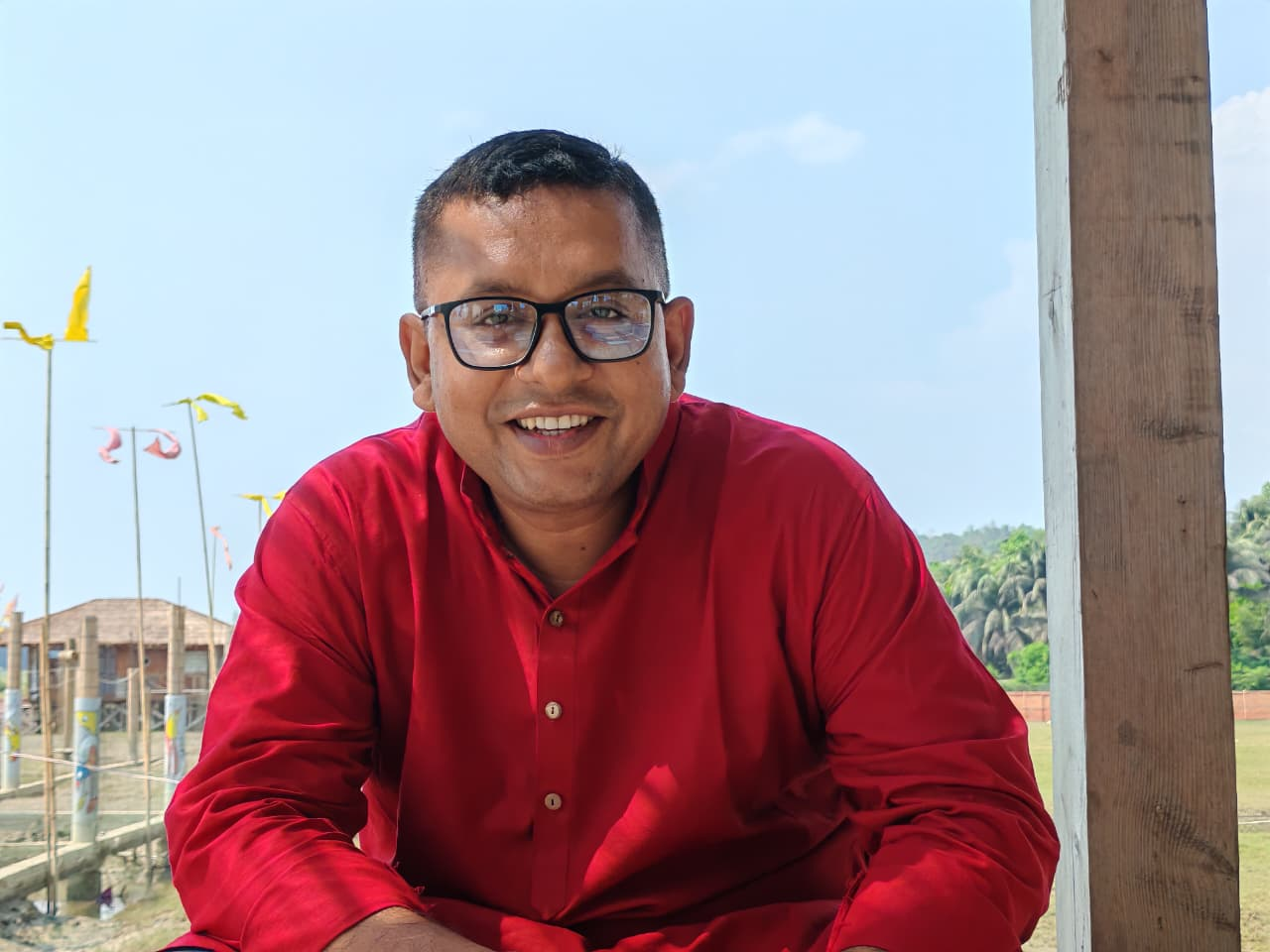
Author: Mamun Kabir, Development Consultant and Environmental Activist